Tamil Nadu Weatherman Update
Posted on: 25/Nov/2017 10:28:26 PM

The last two Low pressure area gave rains to North TN coast and its the turn of south TN to get some rains during the NEM from this third Low pressure of the season.
================
Apologise for not putting the post in the morning!! The 1st and 2nd low pressure area of the NEM during the 1st half of number gave good rains to Delta and Chennai belts. Sadly the belts of Thoothukudi, Ramanathpuram and Kanyakumari have got any major rains till date in this monsoon and are still under drought.
Present Low Pressure - 3rd low pressure after NEM setting in
--------------------------------------
The present low is the third one of the season. This time its little far away from the north TN coast and unlike the past two low pressure which was located in east of Sri Lanka, this one will pass through Sri Lanka and will move into Arabian Sea. So the convergence will happen in South Tamil Nadu. The low pressure will move to Arabian sea too after 28th November in open waters.
Heavy Rainfall alert for South TN in next 2 days
------------------------
For the first time this season, Kanyakumari, Thoothukudi, Tirunelveli, Ramanathapuram has chance of atleast one heavy spell. From tomorrow these region can see their first major spell of the season. Watchout from Manjolai, Papanasam Dam and Kanyakumari ghat areas for very heavy rains. There will be some heavy rains expected in Ghat areas of Tirunelveli. Other district such as Virudhunagar, Delta belt, Sivagnaga, Pudukottai, Dindigul, Theni will also get rains.
Chennai - No heavy rains for Chennai from this low pressure.
----------------------------
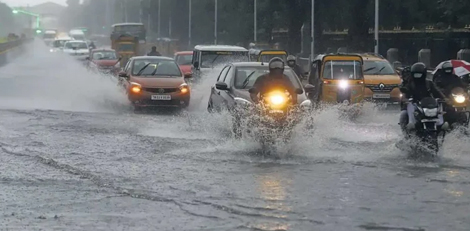
There will be moderate rains in Chennai from the mositure filled easterlies from tomorrow. We dont fall in the core convergence zone, so most of the dense clouds will miss us. Next three days there is going to be pleasant with light and moderate rains at times with occassional sharp intense spells too. So Chennai will have chance of rains with breaks on 26, 27 and 28th November.
Whats next - Is there a 4th low pressure? - Yes and its too early to discuss it now.
--------------------------
Let this Low pressure move into Arabian sea, then our MJO based system will take shape, this is one expected to become into Depression and even cyclone in the 1st week of December.
NEM is still not over!! Please dont believe in any rumors. First week of December needs to be watched for further action as the MJO triggered low develops in Bay of Bengal. Its too early to discuss about that even before that low is born. Let the present low pass away and get our southern district suffering from drought get some good rains.


