Southwest Monsoon forecast for June 1 across India
Posted on: 31/May/2018 3:48:23 PM

Weather systems across the country
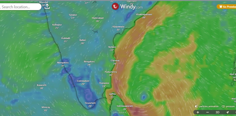
The Northern Limit of Monsoon (NLM) is passing through Shirali, Hassan, Mysuru, Kodaikanal, Tuticorin and east-central Bay of Bengal.
Conditions are favorable for further advance of Southwest Monsoon into some parts of Northeast India during the next 48 hours.
The well-marked low pressure over Myanmar has become insignificant.
Over Punjab and neighboring area lies a cyclonic circulation.
There is another cyclonic circulation over Northeast Rajasthan. From this system extends a trough up to Telangana crosswise Madhya Pradesh and Vidarbha.
One more cyclonic circulation lies over Sub-Himalayan West Bengal and adjacent area.
Monsoon activity in past 24 hours
During the past 24 hours, Monsoon was normal over Kerala, Coastal and South Interior Karnataka, Andaman and Nicobar Islands and Lakshadweep.
Pre-Monsoon showers occurred over Vidarbha, North Madhya Pradesh, Chhattisgarh, West Uttar Pradesh, Bihar, Jharkhand, parts of northeastern states, Odisha, Rajasthan, Uttarakhand, parts of North Interior Karnataka and Tamil Nadu.
Rain activity recorded: Kailashahar 59 mm, Agartala 49 mm, Bengaluru 40 mm, Long Island 29 mm, Thrissur 25 mm, Malda 17 mm, Jharsuguda 14 mm and Punalur 10 mm.
Monsoon forecast in next 24 hours
In the course of next 24 hours, Monsoon will remain weak over Kerala.
Normal Monsoon conditions are expected over Coastal and South Interior Karnataka, Lakshadweep and Andaman and Nicobar Islands.
Pre-Monsoon showers will occur over northeastern states, parts of West Bengal, Jharkhand, North Odisha, Telangana, Rayalaseema, Maharashtra, Chhattisgarh, Bihar, Uttar Pradesh and one or two places over East Madhya Pradesh.
Courtesy: skymetweather.com


