Cyclone Gaja Latest Update (Tamil Nadu Weatherman)
Posted on: 13/Nov/2018 2:44:41 PM

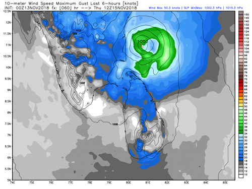
Landfall location is likely between Pondy/Cuddalore to Nagai/Vedharanayam as a very weak Cyclone
============================
The NW movement will stop anytime now and the SW dip will start soon. Once it takes SW route it will be a very fast dip. The stalling happened because of the steering ridge change. Since it has moved up we can expect the landfall location to be little higher between Pondy/Cuddalore to Nagai/Vedaranayam around 15th November noon to night with winds touching 60-70 km/hr and gusting to 80 km/hr. So clearly not a strong cyclone. Rains will be heavy to very heavy around the landfall area.
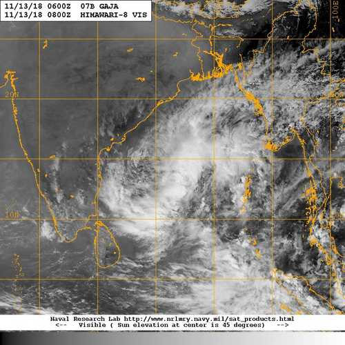
Chennai will see good rains from 14th night / 15th morning but not threatening ones which require BCP. It will be followed by pull effect rains on 16-17th after cyclone moves in Arabian Sea. And then the next low forms around 19-20th in Bay of Bengal.
More updates to follow.
Note: These are just my personal views - As the track and landfall location differs from that of the official agency. Kindly follow the official agency for administrative purposes.
Courtesy :Tamil Nadu Weatherman


