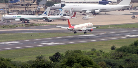
Flight landing in the Chennai city to become smoother now
Posted on: 09/May/2019 9:56:32 AM


Airport Authority of India or AAI has introduced electronic terrain and obstacle data (eTOD) and this could be accessed by the airlines and the pilots. By this flying into Chennai airport would be safer.
The important point here is the data includes accurate height of the buildings, ridges, hills, water bodies, valleys, and other obstacles on a colour coded map. With the help of the data, the pilots would be able to determine safe height that needs to be to be maintained while coming in to land at the airport in Chennai. For the flight safety, the information in the electronic form has been mandated by the ICAO or International Civil Aviation Organisation.
The interesting information gathered is electronic form based information was tried out in Euro-control that controls the flights in Europe. The point is this electronic terrain and obstacle data is now considered as an important feature for flight safety.
There is increase in the obstacles around the airports in the form of buildings and towers. This has led to the need for the system and this was according to a pilot. He then added that planes have become highly sophisticated and the proximity warnings blare or produce harsh sound if there were buildings closer while coming to land.
It must be taken into account that for the planes coming in to land on the Guindy end of the main runway, metro station at Alandur and the elevated line on the Alandur- Meenambakkam stretch with canopy over are considered as obstacles. The point is these structures block the signals from the ILS or Instrument Landing System used by the planes to home in on a runway. For the pilots to adjust the descend altitude, there is a need for clear information regarding the number of obstacles on its approach path. It is now said that the nature of obstacles around an airport would also be understood by the pilot by using this eTOD.
Airport Authority of India or AAI chairman, Mr. Guruprasad Mohapatra, launched this eTOD for as many as 5 airports. Now under this eTOD the terrain around the airports have been mapped and uploaded on to a website. The important information is terrain details are available for area around the runway, area that extends on either end of runway, 10 km radius around an airport and 45 km around the airport. The truth is data would make the landing safer and this was as per an official belonging to AAI.