Cyclone Vardah is expected to make landfall between Mahabalipuram and Nellore
Posted on: 10/Dec/2016 5:37:44 PM
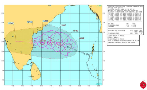
This is not an official forecast as it differs from that of IMD. Please refer IMD for official track.
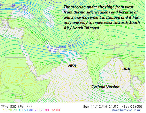
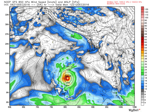
Cyclone Vardah is a Severe cyclone now and as it moves towards the South AP/ North Tamil Nadu coast, it will weaken as a normal Cyclone due to wind shear / dry air and there is a good consensus among all leading numerical models that it is expected to make landfall close to Chennai around pulicat area. At present the cyclone is steered by the deep layered ridge but as it weakens, the mid layered ridge may take partial control (please refer the pic). Meanwhile the JTWC consensus track is just north of Sriharikota. It may come down a bit in the next update.
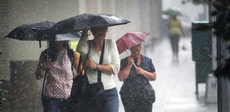
The one good thing of Vardah is that it is expected to retain some clouding and so the north TN belt of Tiruvallur and Chennai and also Kancheepuram will get rains on 12th December. Tomorrow (Sunday), some isolated spells will happen in Chennai. Vellore district may also get rains later on 12/13th.
Expect squally winds of over 60-80 km/hr across Tiruvallur coastal areas and Chennai. Fisherman is strictly advised not to venture into the sea from Tiruvallur, Chennai and Kancheepuram districts. The rains may be heavy close to the landfall area. Chennai too will get good rains from Vardah. I am expecting a much better performance in terms of rainfall for Vardah.
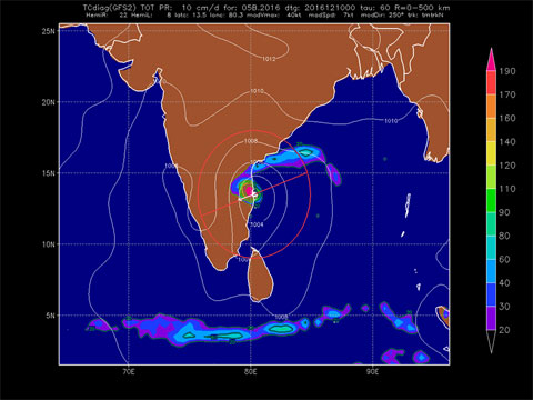
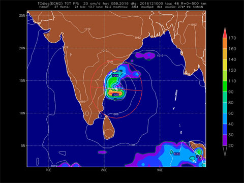
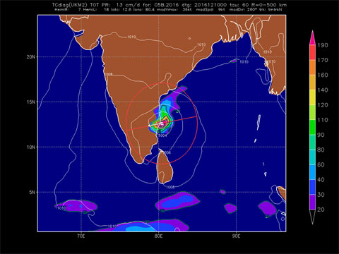
The world Top 3 models track is put up. ECMWF and GFS expect landfall at Pulicat. While the chennai people favorite UKMET (BBC) is taking landfall over South Chennai.
With Just one day to go, there will not be much change in track may be +or- 50 to 75 kms here and there.
Remember we need this spell of rains, hope the landfall further changes just south of Chennai. Then even other interior TN will get rains. Dont worry about floods. More updates to follow.
Photos
1. JTWC track (shown above)
2. Steering - mid level
3. GFS winds on landfall day on 12th in knots
4. GFS track
5. ECMWF track
6. UKMET track
Courtesy - Tamil Nadu Weatherman


