Southwest Monsoon Update (Tamil Nadu Weatherman)
Posted on: 04/Jun/2018 4:13:45 PM

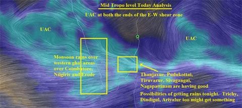
Monsoon is yet to become vigorous in the west coast and will most likely become vigorous by 7th June/8th June. Till then our chances of Thunderstorms exists in North and Central TN through heat based rains. Today the hot spot region picked up models is in the delta region and in following districts of Thanjavur, Pudukottai, Ariyalur, Sivaganga, Tiruvarur and Nagapattinam. Parts of Dindigul, Trichy and Perambalur too might get something. Even Madurai might get something.
Thunderstorms will continue to form in Vellore, Thiruvannamalai, Villupuram, Kancheepuram and Tiruvallur zones. Pondy and Cuddalore belt too will see some action.
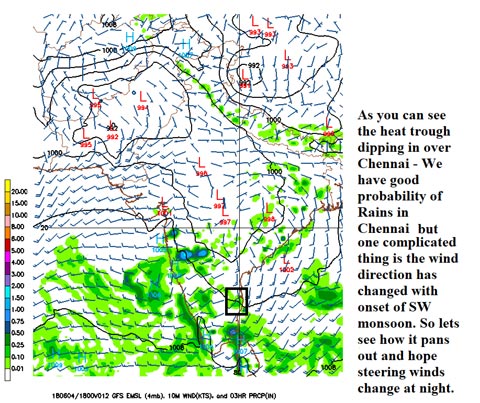
Chennai - Another half chance for us but with complicated wind direction of South to north.

Today too we have some chance of rains in the outskirts, suburbs and if lucky over the Chennai city too. Past two days clouds have glanced Chennai from North West. Today the steering winds have improved however, its not sure shot call as the SW winds are tilted too much in sort of South - North Direction. Today the storms wont move from north instead it has to move from south. Its a complicated direction for getting rains as chances of convergence happening with this direction.
Note: These rains cant be predicted with sure shot call based on models or ur apps and lets hope the winds changes favorable in the night. If something forms, i will put and update. One more point these are not our monsoon rains, so these weak thunderstorms rarely cover entire city. It will rain here and there only.
Courtesy: Tamil Nadu Weatherman


