Buoys share helping hands with weathermen
Posted on: 17/Nov/2018 3:45:46 PM

Instruments anchored deep inside the Bay of Bengal at a depth of 3000m showed signs of likely cyclonic storm. They were of about 500m deep underwater about one week ago. The weather systems started journeying along the Tamil Nadu coast crossing the Bay. And the buoys helped in keeping track of the right path.
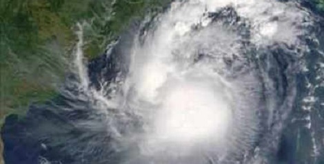
The National Institute of Ocean Technology (NIOT) had used 4 buoys in the Bay and 1 in the Arabian Sea. With this, the IMD could follow up with the Gaja cyclone. These were the very first to send across warning alerts as to the furious storm that may wash out the land.
As the storm is said to have crossed the Bay, there was severe dip in the air pressure and increase in wind speed and temperature of sea surface. There were abnormalities sensed by the sensors fixed at the sea. There was a rapid relay system that helped getting back to normal mode after every half an hour of transmission. These systems also indicated the signs of intensification of the cyclonic storm. Speaking about this, the Director of NIOT said that the values and data given by buoys are additionally helpful in knowing the cyclone�s path.
Over 7 such buoys in the deep sea and 2 of them in the coastal buoys in the Bay of Bengal are being used. Back in 2016, such buoys were helpful in understanding the path of cyclone during Vardah. It was back then that a rapid transmission system was used for the very first time.
According to a report rolled out by the Director of NIOT ocean observation program, Mr. R.Venkatesan, one such buoys of the 4 which is BD11 has sensed the wind speed (at the max) to be 50.92kmph, and the lowest being 1002 hpa, and the peak wave height is identified as 5.1m.
One of the buoys also detected the movement of Gaja along the west after it got weakened casing landfall by evening on Friday.
Various parameters of the cyclone including pressure, direction of wind, SST, etc., are obtained through buoys. These information are really helpful in daily weather forecast as well, say weather experts.


