Cyclone Ockhi to move towards Lakshadweep, damaging rains ahead
Posted on: 30/Nov/2017 4:22:57 PM

The weather system which has been brewing in the Bay of Bengal for a long time has finally intensified into a cyclonic storm today. The Cyclone which has been named Ockhi is the first of the season which was formed in either Bay of Bengal or Arabian Sea and affected the Indian landmasses.
The weather system is at present over Comorin region and adjoining areas, around 340 km west-northwest of Galle, 60 km south of Kanyakumari, 120 km southwest of Thiruvananthapuram and around 480 km east-southeast of Minicoy.
The system is expected to undergo further intensification into a severe cyclonic storm as sea surface temperatures are very warm and vertical wind sheer is also low.
The system will move towards Lakshadweep in a west northwestward direction. Thus, due to this weather system, heavy to very heavy rains are expected over Lakshadweep Islands. In fact, the possibility of extremely heavy rains i.e. three-digit rains is also possible over the region.
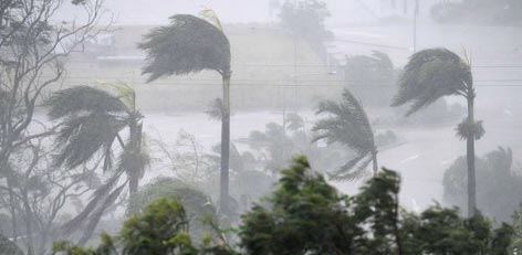
These rainfall activities are expected to continue for at least the next 24 to 48 hours. Sea conditions are expected to remain from rough to very rough. Winds speed may range between 80-90 kmph gusting to 100 kmph from Thursday night as the cyclone gets closer to the Island.
Not only this, considerable damage is also likely which includes power outages, uprooting of trees and water inundation. Fishermen have been advised to stay far away from the coast and not venture out at any cost.
Courtesy: skymetweather.com


